Visual analysis.
No metadata required.
Geolocate any photo
without metadata
Why EXIF Data
Is Often Missing.
Metadata Stripping
Social platforms remove headers on ingest.
Re-export Loss
Screenshots and edits discard EXIF tags.
Privacy Hardening
Device OS often disables GPS tagging.
Compression
Messaging apps drop non-visual packets.
Why EXIF Data
Is Often Missing.
Metadata Stripping
Social platforms remove headers on ingest.
Re-export Loss
Screenshots and edits discard EXIF tags.
Privacy Hardening
Device OS often disables GPS tagging.
Compression
Messaging apps drop non-visual packets.
Operational Pipeline.
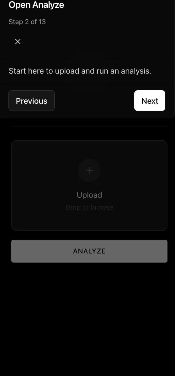
Asset Ingestion
Drag and drop or select any photo. Oceanir works with images that have no GPS or EXIF metadata.
Semantic Dissection
AI examines architectural patterns, terrain features, and signage to identify location signatures.
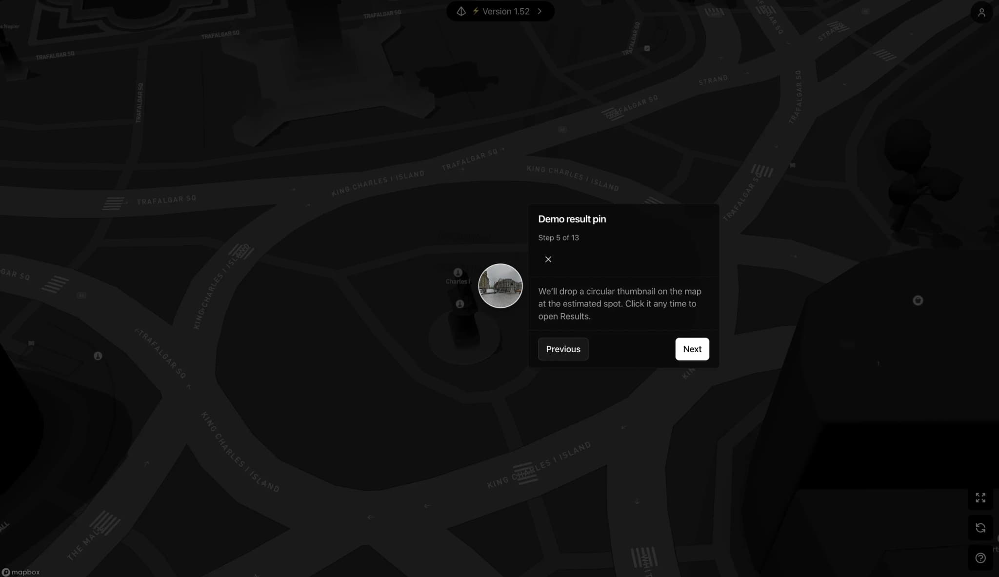
Grid Correlation
Visual fingerprints are compared against city-scale reference databases to surface candidate locations.
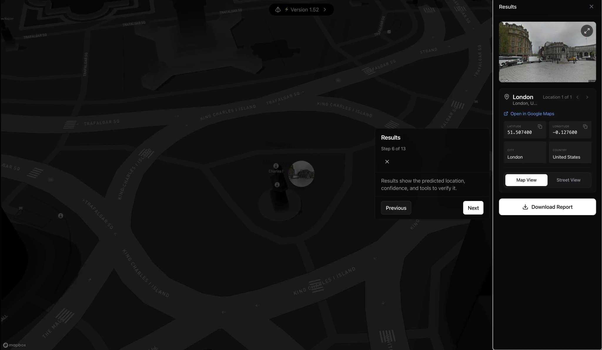
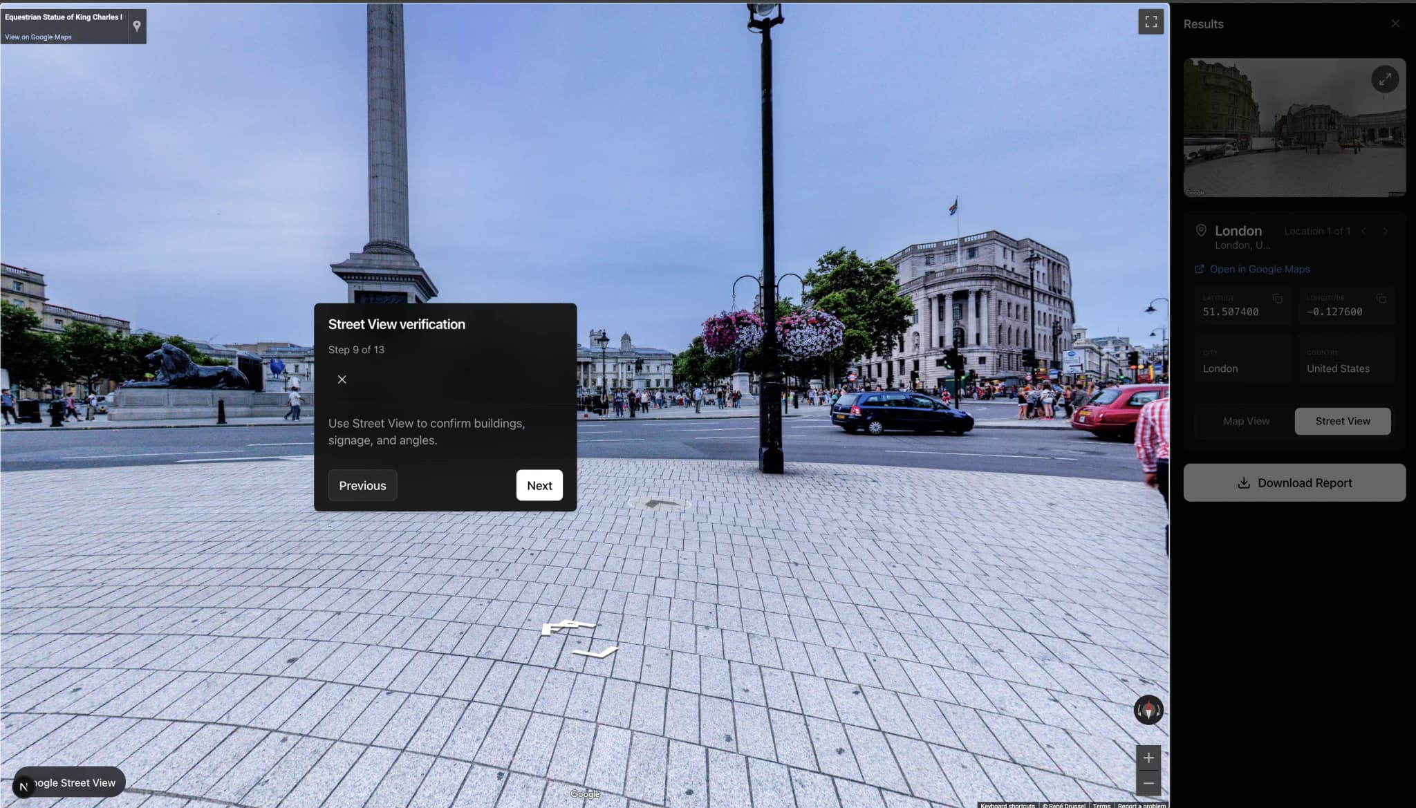
Forensic Report
Receive ranked location candidates with map-based evidence and verification tools.
Supported Cities.
High-accuracy models for select metropolitan areas, with coverage expanding continuously through local grid deployments.
Miami
New York
Chicago
Atlanta
London
Paris
Built for Professionals.
Visual Investigation
Verify incident locations from user-generated content and social media imagery.
Journalism
Authenticate photos and validate claims with geographic evidence.
Research
Analyze field imagery and establish geographic context for studies.
Response Teams
Triage location-specific reports and coordinate with map-backed data.
Common
Questions.
Technical specifications and operational details for geolocating photos without metadata.
Ready to try Oceanir?
Upload any photo and discover where it was taken - no metadata required. Start free with 10 analyses per month.